news

Wear your school spirit for Mayor, Coach Owen

By Joanne Beck

Friends of Jim Owen are asking that attendees of this Saturday's funeral who work at a school or had Jim as a teacher at school to please wear your school apparel or colors to the service. 

"That is what Jim is all about, he's being buried in the jacket from his obituary picture," friend Michael Marsh said.

The funeral service will be at 11 a.m. Saturday at Northgate Free Methodist Church, 8160 Bank Street Road, Batavia.

For those that can't attend, the service will be livestreamed and available for viewing online

Weather-related cancellations for Genesee County

By Joanne Beck

Cancellations for Wednesday, Jan. 25 are below. This list will be updated as we receive submissions. Send cancellations to news@thebatavian.com.

  • Alabama Fire has canceled bingo due to the weather.
  • All after school and evening activities at Batavia City School District have been canceled for Wednesday.
  • The BHS Opening Reception at GO ART! has been canceled this evening. It has been rescheduled for Feb. 15.  
  • Due to the deteriorating weather conditions, Elba Central School is canceling all afterschool and evening activities for Wednesday.
  • Northgate FMC Wednesday Night 7 p.m. Men's Group has been canceled.

AG Letitia James defends provocative letter to ReAwaken hosts

By Joanne Beck

In covering a lawsuit filed by organizers of the Batavia-based ReAwaken America Tour against Attorney General Letitia James, The Batavian reached out to James for comment Monday and did not hear back before the story was published.

We wanted to know why she felt it necessary to involve herself — a state official — with a religious/political event; what she was hoping to accomplish by issuing the warning; and how she intends to defend her stance given that the event did not include any visible threats of violence as predicted.

An AG office spokesperson said that "As the top law enforcement officer in the state, it is our job to remind any organization or individual about the laws in our state, especially those that protect New Yorkers against racially motivated violence or harassment.”

“The letter from our office served as a basic reminder of those very laws and to suggest otherwise is incorrect,” the spokesperson said.

The office also included a copy of the letter, which The Batavian already had, and included portions in its published story. The full letter can be read below, and outlines the attorney general’s concerns and the foundation upon which organizers Pastor Paul Doyle and Clay Clark, in collaboration with their attorney, used to file the lawsuit against James for defamation, libel and impinging their First Amendment rights, to boil down the lengthy scope of litigation material.

To sum it up, event organizers sued the attorney general, alleging defamation and a violation of their civil rights. She, in turn, is standing by her letter, suggesting it is her right as the state's “top law enforcement official” to send such letters to private citizens. 

Here is the letter in full, dated August 3, 2022, sent to General Michael Flynn and Clay Clark, care of Cornerstone Church in Batavia:

General Michael Flynn and Clay Clark:

As New York’s top law enforcement officer, I have significant concerns that the ReAwaken America Tour’s upcoming event at the Cornerstone Church in Batavia, New York on August 12 and 13 could spur extremist or racially motivated violence.

These concerns center around the event’s proposed dates, which coincide with the five-year anniversary of the deadly Unite the Right rally in Charlottesville, Virginia, and past extremist statements made by yourselves and the other featured speakers on the tour.

I am especially concerned about featured speakers’ regular allusions to white nationalist ideals connected to the “Great Replacement Theory,” a conspiracy theory that warns of white genocide and efforts to replace native born Americans with immigrants. The theory is frequently linked to violent actions, including the racially motivated mass shooting that killed 10 people at a Tops Friendly Markets store in Buffalo.

 Especially in light of this racist mass shooting, and other recent episodes of racially motivated violence in New York and throughout the country, the Office of the Attorney General is concerned that such rhetoric could contribute to violent or unlawful conduct at the ReAwaken America Tour’s upcoming event.

The Office of the Attorney General writes to remind you that New York law prohibits racially motivated violence, harassment, or interference with another person in the exercise of their civil rights.

New York Civil Rights Law § 79-n empowers the Office of the Attorney General to investigate acts of violence, intimidation, threats, or harassment directed at people based on a belief or perception regarding an individual’s race, color, national origin, ancestry, gender, religion, religious practice, age, disability, or sexual orientation. In addition to actual damages, any person who violates this statute can be held liable for $5,000 in penalties for each violation.

Additionally, New York Civil Rights Law § 40-c prohibits discriminating against another person in the exercise of their civil rights — including their right to peacefully protest — based on similar protected characteristics.

Finally, New York Executive Law § 63(12) empowers the Office of the Attorney General to take action against any business engaged in significant fraud or illegality — including the violation of New York’s civil rights laws.

The Office of the Attorney General has a duty to protect New Yorkers from extremist and racially motivated violence. We stand ready to investigate any violation of the laws above and, if necessary, to enforce them to the fullest extent available.

You are therefore instructed to take all necessary steps to ensure that the event complies fully with the requirements of New York’s civil rights laws and all other applicable state and federal statutes.

Your cooperation in ensuring a peaceful and law-abiding event will be greatly appreciated.

Sincerely,

LETITIA JAMES

New York State Attorney General

CC: Cornerstone Church

Photo of NYS Attorney General Letitia James from her website.

Grand Jury Report: Motorcyclist charged with manslaughter in death of teenager

By Howard B. Owens

Christopher R. Scinta is indicted on counts of manslaughter in the second degree, a Class C felony, leaving the scene of a property damage accident, a Class C felony, reckless driving, a Class A misdemeanor, criminal mischief in the fourth degree, a Class A misdemeanor, two counts of obstructing governmental administration, a Class A misdemeanor, obstructing emergency medical personal, a Class misdemeanor, and speeding, a violation. Scinta is accused of causing the death of Jasmyne Rubel at the roundabout in the City of Batavia on Nov. 4. He is accused of leaving the scene of a personal injury accident without notifying police of the accident. He is accused of driving a 2006 Kawasaki in a reckless manner. He's accused of intentionally damaging window blinds in interview room #2 at the Batavia Police Department. He is accused of attempting to interfere with a government official's lawful duty. He is accused of interfering with the medical treatment of Jasmyne Rubel by a qualified first responder. 

Cindy L. Bush is indicted on a felony count of DWI and of aggravated unlicensed operation. Bush is accused of driving drunk on April 24 in the City of Batavia on Ross Street in a 2004 Chevrolet. The indictment alleges a prior conviction within the past 10 years for DWI in February 2015 in the City of Batavia.

David J. Leroy is indicted on a count of criminal possession of a weapon 3rd, a Class D felony. Leroy is accused of knowingly possessing a switchblade knife in the Town of Pembroke on July 25.

Geovanny Lopez is indicated a felony count of DWI, aggravated unlicensed operation in the first degree, a Class E felony, and circumventing an interlock device, a Class A misdemeanor. Lopez is accused of driving a 2009 Ford on the I-490 on Aug. 4 in the Town of Le Roy. The indictment alleges that Lopez was convicted of DWI with the past 10 years, on Dec. 12, 2016, in Yonkers.

Shannon L. Marvin is indicted on a count of grand larceny in the fourth degree, a Class E felony. Marvin is accused of stealing a Discover card belonging to another person in the Town of Bergen during the month of October in 2021.

BPD raises $1,560 for Genesee Cancer Assistance in Movember

By Press Release

Press release:

The Batavia Police Department has closed out the Movember / Don’t Shave December campaigns for 2022. The department was able to raise $1,560 for Genesee Cancer Assistance. Department members would like to thank the community for their support and donations.

The Movember Worldwide Campaign started in 2003 in Australia and has since grown. Movember was created to bring awareness to Men’s Health, specifically, prostate cancer, testicular cancer, mental health, and suicide prevention.

Submitted photo.

LEGAL NOTICE: Town of Pembroke schedules public hearing for Water District #5

By Legal Notices

PUBLIC NOTICE:

At a Special Meeting of the Town Board of the Town of Pembroke, held at the Town Hall in said Town of Pembroke, County of Genesee, State of New York on the 18th day of January, 2023.

PRESENT:

Thomas Schneider, Supervisor
Kathleen Manne, Councilperson
Edward Arnold, Jr., Councilman

In the Matter of ORDER CALLING PUBLIC HEARING

The Establishment of Water District #5 (Pratt Rd) in the Town of Pembroke, Genesee County, New York under Town Law Article 12-A.

Click the headline for more ... 

WHEREAS, A map, plan and report have been prepared in a manner and detail as determined by the Town Board of the Town of Pembroke, regarding the establishment of a proposed   Water District No. 5 in the Town of Pembroke.

The map, plan and report have been filed in the Town Clerk’s Office in the Town on the 2nd day of June 2021.

The map, plan and report were prepared by Jeremy DeLyser, P.E., of Clark Patterson Lee, a competent engineer, licensed by the State of New York, showing the boundaries of the proposed district, a general plan of the distribution system and a report of the proposed methods of operation and the estimated maximum cost of said proposed district. The map depicts the boundaries of the proposed district.

The boundaries are as follows;

Beginning at the intersection of the easterly municipal boundary line of the Town of Pembroke/Town of Batavia, and the center line of Slusser Road (49.5 feet wide right-of-way); thence,

  1. Southerly, along the easterly municipal boundary line of the Town of Pembroke/Town of Batavia, a distance of 507 feet, more or less, to the southerly property line of tax account number 17.-2-10.1; thence,
  2. Westerly, along the southerly line of tax account number 17.-2-10.1, a distance of 330 feet, more or less, to a point 500 feet southerly of and parallel to the center line of Slusser Road; thence,
  3. Northwesterly, through the lands of tax account numbers 17.-2-10.1, 17.-2-10.2, and 17.-2-31.21, along a line 500 feet southerly of and parallel to the center line of Slusser Road, a distance of 1,868 feet, more or less, to a point on a southerly line of tax account number 17.-2-31.21; thence,
  4. Northwesterly, along the southerly lines of the tax account numbers 17.-2-31.21, 17.-2-31.12, 17.-1-48.11, 17.-1-48.12, 17.-1-49, 17.-1-50.1, 17.-1-50.2, and 17.-1-75, to the easterly extension of a line of tax account number 17.-1-75; thence,
  5. Westerly, across Tonawanda Creek, along the easterly extension of a southerly line of tax account number 17.-1-75, and a southerly line of tax account number 17.-1-75, a distance of 325 feet, more or less, to the westerly line of tax account number 17.-1-75; thence,
  6. Northwesterly, along the westerly line of tax account number 17.-1-75, and the northerly extension of the westerly line of tax account number 17.-1-75 a distance of 337 feet, more or less, to the center line of Pratt Road; thence,
  7. Westerly, along the center line of Pratt Road, a distance of 148 feet, more or less, to the southerly extension of a westerly line of tax account number 17.-1-11; thence,
  8. Northwesterly, along the southerly extension of a westerly line of tax account number 17.-1-11, and a westerly line of tax account number 17.-1-11, a distance of 448 feet, more or less, to a northerly line of tax account number 17.-1-11; thence,
  9. Easterly, along a northerly line of tax account number 17.-1-11, a distance of 165 feet, more or less, to a westerly line of 17.-1-11; thence,
  10. Northwesterly, along a westerly line of tax account number 17.-1-11, a distance of 290 feet, more or less, to a westerly line of tax account number 17.-1-11; thence,
  11. Easterly, along a northerly line of tax account number 17.-1-11, the easterly extension of the northerly line of tax account number 17.-1-11, and the existing Town of Pembroke Water District No. 1, a distance of 762 feet, more or less, to a southerly line of tax account number 17.-1-18; thence,
  12. Northwesterly, along the southerly line of tax account number 17.-1-18, a distance of 541 feet, more or less, to a point 500 feet westerly of and parallel to the center line of Pratt Road (49.5 feet wide right-of-way; thence,
  13. Northerly, through the lands of tax account numbers 17.-1-18, 17.-1-19.12, 17.-1-19.11, and 17.-1-21.111, along a line 500 feet westerly of and parallel to the center line of Pratt Road, a distance of 1,528 feet, more or less, to a northerly line of tax account number 17.-1-21.111; thence,
  14. Northeasterly, along a northerly line of tax account number 17.-1-21.111, a distance of 323 feet, more or less, to a westerly line of tax account number 17.-1-21.111; thence,
  15. Northwesterly, along a westerly line of tax account number 17.-1-21.111, a distance of 116 feet, more or less to a northerly line of tax account number 17.-1-21.111; thence,
  16. Northeasterly, along a northerly line of tax account number 17.-1-21.111, and the westerly lines of tax account numbers 17.-1-35 and 17.-1-36, a distance of 684 feet, more or less, to the northwesterly corner of tax account number 17.-1-36; thence,
  17. Southeasterly, along the northerly line of tax account number 17.-1-36, a distance of 68 feet, more or less, to an angle point; thence,
  18. Easterly, along the northerly lines of tax account numbers 17.-1-36, 17.-1-37, 17.-2-2.212, 17.-2-2.211, and 17.-2-2.1, a distance of 1,863 feet, more or less, to the northeasterly corner of tax account number 17.-2-2.1; thence,
  19. Southerly, along the easterly line of tax account number 17.-2-2.1, and the southerly extension of the easterly line of tax account number 17.-2-2.1, a distance of 330 feet, more or less, to the center line of Pratt Road; thence,
  20. Easterly, along the center line of Pratt Road, a distance of 70 feet, more or less, to the southwesterly extension of the westerly line of tax account number 17.-2-3; thence,
  21. Northeasterly, along the southwesterly extension of the westerly line of tax account number 17.-2-3, and the westerly line of tax account number 17.-2-3, a distance of 336 feet, more or less, to the northerly line of tax account number 17.-2-3; thence,
  22. Easterly, along the northerly lines of tax account numbers 17.-2-3, 17.-2-5, 17.-2-4, 17.-2-38, 17.-2-39, 17.-2-40, 17.-2-41, 17.-2-42, 17.-2-43, 17.-2-44, and 17.-2-45, a distance of 1,179 feet, more or less, to the easterly line of tax account number 17.-2-45; thence,
  23. Southerly, along the easterly municipal boundary line of the Town of Pembroke/Town of Batavia, a distance of 803 feet, more or less, to the southerly line of tax account number 17.-2-6.2; thence,
  24. Westerly, along the southerly lines of tax account numbers 17.-2-6.2 and 17.-2-6.12, a distance of 408 feet, more or less, to the westerly line of tax account number 17.-2-6.12; thence,
  25. Northerly, along the westerly line of tax account number 17.-2-6.12, a distance of 124 feet more or less, to the southerly line of tax account number 17.-2-46; thence,
  26. Westerly, along the southerly lines of tax account numbers 17.-2-46, 17.-2-47, 17.-2-49.1, 17.-2-55.2, and 17.-2-6.112, a distance of 662 feet, more or less, to the easterly line of tax account number 17.-2-51; thence,
  27. Southwesterly, along an easterly lines of tax account numbers 17.-2-51 and 17.-2-53.1, a distance of 143 feet, more or less, to a northerly line of tax account number 17.-2-53.1; thence,
  28. Easterly, along a northerly line of tax account number 17.-2-53.1, a distance of 206 feet, more or less, to an easterly line of tax account number 17.-2-53.1; thence,
  29. Southeasterly, along an easterly line of tax account number 17.-2-53.1, a distance of 96 feet, more or less, to a southerly line of tax account number 17.-2-53.1; thence,
  30. Westerly, along a southerly line of a tax account number 17.-2-53.1, a distance of 40 feet, more or less, to a point 500 feet easterly of and parallel to the center line of Slusser Road; thence,
  31. Southwesterly, through the lands of tax account numbers 17.-2-6.111 and 17.-2-7, along a line 500 feet easterly of and parallel to the center line of Slusser Road, a distance of 667 feet, more or less, to the southerly line of tax account number 17.-2-7; thence,
  32. Westerly, along a southerly line of tax account number 17.-2-7, a distance of 199 feet, more or less, to an easterly line of tax account number 17.-2-7; thence,
  33. Southerly, along the westerly line of tax account number 17.-2-8, a distance of 1,952 feet, more or less, to a point 500 feet northerly of and parallel to the center line of Slusser Road; thence,
  34. Southeasterly, through the lands of tax account numbers 17.-2-8, along a line 500 feet easterly of and parallel to the center line of Slusser Road, a distance of 1,390 feet, more or less, to the easterly municipal boundary line of the Town of Pembroke/Town of Batavia; thence,
  35. Southerly, along the easterly municipal boundary line of the Town of Pembroke/Town of Batavia, a distance of 530 feet, more or less, to the Point of Beginning.

Pratt Road/Water District #5, as described above, contains approximately 309 acres of land.

All as shown on a map prepared by CPL, entitled “Pratt Road Water District – Water District Map”, dated May 20, 2020.

WHEREAS, the improvements proposed consist of construction and maintenance of a water system, to serve the said district, including water mains, and distribution pipes to be installed at the sole expense of the residents of the district and no public funds will be expended therefore; and

WHEREAS, the maximum amount proposed to be expended for the improvements (or, the maximum amount proposed to be expended for the performance or supplying of services) as stated in the said Map. Plan and Report is the sum of Two Million Fifty five Thousand and no/100 Dollars ($2,055,000.00) of which Nine Hundred Four Thousand Dollars and no/100 ($904,000.00) will be provided by USDA Rural Development in the form of a grant and One Million One Hundred Fifty-one Thousand Dollars and no/100 ($1,151,000.00) will be provided by a loan from USDA Rural Development at a rate of 1.75% over a period of 38 years; and

WHEREAS, the total estimated cost after the first year of service for equivalent dwelling units is $1,048.00, of which $552.00 will be paid toward debt service and $496.00 will be paid toward annual water costs (including operation and maintenance costs) Total one time estimated costs per equivalent dwelling unit for installation are estimated to be $1,140.00.

NOW THEREFORE IT IS HEREBY:

ORDERED, that a public hearing before the Town Board of the Town of Pembroke, shall be held at the Pembroke Town Hall, 1145 Main Road Corfu, New York on the 9th day of February, 2023 at 6:30 p.m. to hear the residents and landowners in the proposed district  interested in the subject thereof, concerning the same, and for such other action on the part of said Town Board as may be required by law or proper in the premises.

Dated:  January 18th, 2023

Motion made by: Supervisor Schneider
Seconded by: Councilman Arnold
Ayes: Manne, Arnold, Schneider
Nays: None

APPROVED by: Unanimous vote (3-0)

State of New York) County of Genesee)    ss:

I, Nicole Begin, Town Clerk of the Town of Pembroke, Genesee County, New York, do hereby certify that I have compared the preceding Order with the original thereof filed in my office in Pembroke, New York on the 18th of January, 2023, and that the same is a true and correct copy of said original and of the whole thereof.

In Testimony whereof, I have hereunto set my hand and affixed the seal of said Town, this 18th day of January, 2023.

Nicole Begin

Town Clerk of the Town of Pembroke

Genesee County, New York


Stafford Republican Committee seeks candidates

By Press Release

Press Release:

The Town of Stafford Republican Committee is seeking registered party members that are interested in receiving party endorsement for political office. The following offices will be elected on Nov. 7, 2023, in the general election.   All elected offices are four-year terms.

  • County Legislature for the Town of Stafford and Town of Batavia
  • Town of Stafford Supervisor
  • Town of Stafford Council, two vacancies
  • Town of Stafford Judge, two vacancies
  • Town of Stafford Republican committee, two vacancies for District One

Those interested in these positions should contact Stafford Republican Committee Chairwoman Mary Alice Panek, 6361 Thwing Road, LeRoy, NY, 14482, or email staffordnyrepublicancommittee@gmail.com with a resume and letter of interest.  Please send information before Feb. 10, 2023.

LEGAL NOTICE: Town of Pembroke schedules public hearing for Water District #4

By Legal Notices

PUBLIC NOTICE:

At a Special Meeting of the Town Board of the Town of Pembroke, held at the Town Hall in said Town of Pembroke, County of Genesee, State of New York on the 18th day of January, 2023.

PRESENT:

Thomas Schneider, Supervisor
Kathleen Manne, Councilperson
Edward Arnold, Jr., Councilman

In the Matter of ORDER CALLING PUBLIC HEARING
The Establishment of Water District #4  in the Town of Pembroke, Genesee County, New York under Town Law Article 12-A.

Click the headline for more ...

WHEREAS, A map, plan and report have been prepared in a manner and detail as determined by the Town Board of the Town of Pembroke, regarding the establishment of a proposed   Water District No. 4 in the Town of Pembroke.

The map, plan and report have been filed in the Town Clerk’s Office in the Town on the 2nd      day of June 2021.

The map, plan and report were prepared by Jeremy DeLyser, P.E., of Clark Patterson Lee, a competent engineer, licensed by the State of New York, showing the boundaries of the proposed district, a general plan of the distribution system and a report of the proposed methods of operation and the estimated maximum cost of said proposed district. The map depicts the boundaries of the proposed district.

The boundaries are as follows;

Beginning at a point, being the northwesterly corner of the Existing Extension No. 1 to the Existing Town of Pembroke Water District No. 1 and the intersection of the centerline of Gabbey Road (C.R. 4) (66 feet wide right-of-way) and a westerly extension of a southerly line of tax account number 10.-1-31.111; thence,

  1. Northerly, along the centerline of Gabbey Road and an easterly line of the Existing Town of Pembroke Water District No. 1, a distance of 174 feet, more or less, to a northeasterly corner of the Existing Town of Pembroke Water District No. 1; thence,
  2. Southwesterly, along a northerly line of the Town of Pembroke Water District No. 1, through the lands of tax account number 10.-1-38.115, a distance of 862 feet, more or less, to a point on the southwesterly line of tax account number 10.-1-38.115, 500 feet northeasterly of and parallel to the centerline of Gabbey Road; thence,
  3. Northwesterly, along the southwesterly line of tax account number 10.-1-38.115, a distance of 307 feet, more or less, to a southwesterly corner of tax account number 10.-1-38.115; thence,
  4. Northerly, along the westerly line of tax account number 10.-1-38.115, a distance of 400 feet, more or less, to the northwesterly corner of tax account number 10.-1-38.115; thence,
  5. Easterly, along the northerly line of tax account number 10.-1-38.115, a distance of 514 feet, more or less, a point 500 feet westerly of and parallel to the centerline of Gabbey Road; thence,
  6. Northerly, along a line 500 feet westerly of and parallel to the centerline of Gabbey Road, through the lands of tax account numbers 10.-1-52, 10.-1-51, 10.-1-50, 10.-1-1.112, 10.-1-2.123, 10.-1-49, 10.-1-48, and 10.-1-46.1, a distance of 2,006 feet, more or less, to the northerly line of tax account number 10.-1-46.1; thence,
  7. Easterly, along the northerly line of tax account number 10.-1-46.1, a distance of 70 feet, more or less, to the southwesterly corner of tax account number 10.-1-2.21; thence,
  8. Northerly, along the westerly line of tax account number 10.-1-2.21, a distance of 125 feet, more or less, to the southerly line of tax account number 9.-1-64; thence,
  9. Westerly, along the southerly line of tax account number 9.-1-64, a distance of 519 feet, more or less, to the southwesterly corner of tax account number 9.-1-64; thence,
  10. Northerly, along the westerly line of tax account number 9.-1-64, a distance of 422 feet, more or less, to a point 500 feet southerly of and parallel to the centerline of Akron Road (99 feet wide right-of-way); thence,
  11. Westerly, along a line 500 feet southerly of and parallel to the centerline of Akron Road, through the lands of tax account numbers 9.-1-65.11, 9.-1-66, 8.-1-13.11, and 8.-1-13.12, a distance of 2,598 feet, more or less, to the westerly line of tax account number 8.-1-13.12; thence,
  12. Northerly, along the westerly line of tax account number 8.-1-13.12, a distance of 269 feet, more or less, to the southeasterly corner of tax account number 8.-1-12; thence,
  13. Westerly, along the southerly line of tax account number 8.-1-12, a distance of 250 feet, more or less, to the easterly line of tax account number 8.-1-16.21; thence,
  14. Southerly, along the easterly line of tax account number 8.-1-16.21, a distance of 51 feet, more or less, to the southeasterly corner of tax account number 8.-1-16.21; thence,
  15. Westerly, along the southerly line of tax account number 8.-1-16.21, a distance of 577 feet, more or less, to a point 500 feet easterly of and parallel to the centerline of Marble Road (49.5 feet wide right-of-way); thence,
  16. Southerly, along a line 500 feet easterly of and parallel to the centerline of Marble Road, through the lands of tax account numbers 8.-1-16.121, and 8.-1-16.112, a distance of 2,054 feet, more or less, to the easterly line of tax account number 8.-1-17.2; thence,
  17. Southeasterly, along the easterly lines of tax account numbers 8.-1-17.2, 14.-2-66, and 14.-2-1.112, a distance of 1,009 feet, more or less, to the southeasterly corner of tax account number 14.-2-1.112; thence,
  18. Westerly, along the southerly line of tax account number 14.-2-1.112, a distance of 163 feet, more or less, to the northwesterly corner of tax account number 14.-2-1.111; thence,
  19. Southerly, along the easterly line of tax account number 14.-2-1.111, a distance of 400 feet, more or less, to the southwesterly corner of tax account number 14.-2-1.111 and a northeasterly corner of the Existing Extension No. 1 to the Existing Town of Pembroke Water District No. 1; thence,
  20. Westerly, along the southerly line of tax account number 14.-2-1.111, across Marble Road, along the southerly line of tax account number 14.-1-18.2, and along a northerly line of the Existing Extension No. 1 to the Existing Town of Pembroke Water District No. 1, a distance of 1,093 feet, more or less, to the southwesterly corner of tax account number 14.-1-18.2 and a northwesterly corner of the Existing Extension No.1 to the Existing Town of Pembroke Water District No. 1; thence,
  21. Southerly, along the easterly line of tax account number 14.-1-17.1 and along a westerly line of the Existing Extension No. 1 to the Existing Town of Pembroke Water District No. 1 and the Existing Town of Pembroke Water District No. 1, a distance of 1,811 feet, more or less, to the southeasterly corner of tax account number 14.-1-17.1 and a southwesterly corner of the Existing Town of Pembroke Water District No. 1; thence,
  22. Southwesterly, along a line perpendicular to the northerly right-of-way line of Knapp Road (49.5 feet wide right-of-way) and along a northwesterly line of the Existing Extension No. 1 to the Existing Town of Pembroke Water District No. 1, a distance of 50 feet, more or less, to the southeasterly corner of tax account number 14.-1-15 and a northwesterly corner of the Existing Extension No. 1 to the Existing Town of Pembroke Water District No. 1; thence,
  23. Westerly, along the southerly line of tax account number 14.-1-15 and along a northerly line of the Existing Extension No. 1 to the Existing Town of Pembroke Water District No. 1, a distance of 1,018 feet, more or less, to the southwesterly corner of tax account number 14.-1-15; thence,
  24. Northerly, along the westerly line of tax account number 14.-1-15, a distance of 269 feet, more or less, to a point 500 feet southwesterly of and parallel to the centerline of Knapp Road; thence,
  25. Northwesterly and westerly along a line 500 feet southerly of and parallel to the centerline of Knapp Road, through the lands of tax account number 14.-1-14.1, 14.-1-13.111, 14.-1-6.1, and 14.-1-5.113, a distance of 4,461 feet, more or less, to the easterly line of tax account number 14.-1-84; thence,
  26. Southerly, along the easterly line of tax account number 14.-1-84, a distance of 149 feet, more or less, to the southeasterly corner of tax account number 14.-1-84; thence,
  27. Westerly, along the southerly line of tax account number 14.-1-84, a distance of 210 feet, more or less, to the southwesterly corner of tax account number 14.-1-84; thence,
  28. Northerly, along the westerly line of tax account number 14.-1-84, a distance of 150 feet, more or less, to a point 500 feet southerly of and parallel to the centerline of Knapp Road; thence,
  29. Westerly, along a line 500 feet southerly of and parallel to the centerline of Knapp Road, through the lands of tax account numbers 14.-1-5.112, 14.-1-3.113, 14.-1-86, 14.-1-3.112, and 14.-1-2.1, a distance of 1,763 feet, more or less, to the westerly line of tax account number 14.-1-2.1 and the westerly line of the Town of Pembroke Municipal Boundary; thence,
  30. Northerly, along the westerly line of the Town of Pembroke Municipal Boundary and along the westerly line of tax account number 14.-1-2.1, across Knapp Road, and along the westerly line of tax account number 14.-1-1.2, a distance of 1,000 feet, more or less, to a point 500 feet northerly of and parallel to the centerline of Knapp Road; thence,
  31. Easterly, along a line 500 feet northerly of and parallel to the centerline of Knapp Road, through the lands of tax account number 14.-1-1.2, a distance of 81 feet, more or less, to the westerly line of tax account number 14.-1-1.12; thence,
  32. Northerly, along the westerly line of tax account number 14.-1-1.12, a distance of 500 feet, more or less, to the northwesterly corner of tax account number 14.-1-1.12; thence,
  33. Easterly, along the northerly lines of tax account numbers 14.-1-1.12 and 14.-1-97, a distance of 604 feet, more or less, to the northeasterly corner of tax account number 14.-1-97; thence,
  34. Southerly, along the easterly line of tax account number 14.-1-97, a distance of 11 feet, more or less, to a northwesterly corner of tax account number 14.-1-4.11; thence,
  35. Easterly, along a northerly line of tax account number 14.-1-4.11, a distance of 910 feet, more or less, to a northwesterly corner of tax account number 14.-1-4.11; thence,
  36. Northerly, along the westerly lines of tax account numbers 14.-1-4.11, 8.-1-38.121, 8.-1-54, 8.-1-37.111, and 8.-1-37.12, a distance of 2,409 feet, more or less, to the southeasterly corner of tax account number 8.-1-50; thence,
  37. Westerly, along the southerly lines of tax account numbers 8.-1-50, 8.-1-40.115, 8.-1-57 and through the lands of tax account number 8.-1-56-1 along the westerly extension of the southerly line of tax account number 8.-1-57, a distance 1,043 feet, more or less, to the easterly line of tax account number 8.-1-40.2; thence,
  38. Southerly, along the easterly line of tax account number 8.-1-40.2, a distance of 255 feet, more or less, to the southeasterly corner of tax account number 8.-1-40.2; thence,
  39. Westerly, along the southerly line of tax account number 8.-1-40.2 and along a westerly extension of the southerly line of tax account number 8.-1-40.2, through the lands of tax account number 8.-1-46, a distance of 729 feet, more or less, to the westerly line of tax account number 8.-1-46 and the westerly line of the Town of Pembroke Municipal Boundary; thence,
  40. Northerly, along the westerly line of tax account number 8.-1-46, across Akron Road (66 feet wide right-of-way), and along the westerly line of tax account number 8.-1-45, also along the westerly line of the Town of Pembroke Municipal Boundary, a distance of 1,556 feet, more or less, to the northwesterly corner of tax account number 8.-1-45; thence,
  41. Easterly, along the northerly lines of tax account numbers 8.-1-45, 8.-1-41.1, 8.-1-41.2, and 8.-1-42, and along an easterly extension of the northerly line of tax account number 8.-1-42, a distance of 1,828 feet, more or less, to the centerline of Tesnow; thence,
  42. Northerly, along the centerline of Tesnow Road, a distance of 477 feet, more or less, to a point 500 feet northerly of and parallel to the centerline of Akron Road; thence,
  43. Easterly, along a line 500 feet northerly of and parallel to the centerline of Akron Road, through the lands of tax account numbers 8.-1-7, 8.-1-8.1, 8.-1-9.1, 8.-1-10.12, and 8.-1-11.111, a distance of 8,476 feet, more or less, to a point 500 feet westerly of and parallel to the centerline of Hopkins Road (66 feet wide right-of-way); thence,
  44. Northerly, along a line 500 feet westerly of and parallel to the centerline of Hopkins Road, through the lands of tax account number 8.-1-11.111, a distance of 577 feet, more or less, to a southerly line of tax account number 8.-1-11.221; thence,
  45. Westerly, along a southerly line of tax account number 8.-1-11.221, a distance of 30 feet, more or less, to the southwesterly corner of tax account number 8.-1-11.221; thence,
  46. Northerly, along a westerly line of tax account number 8.-1-11.221, a distance of 225 feet, more or less, to a northwesterly corner of tax account number 8.-1-11.221; thence,
  47. Easterly, along a northerly line of tax account number 8.-1-11.221, a distance of 29 feet, more or less, to a point 500 feet westerly of and parallel to the centerline of Hopkins Road; thence,
  48. Northerly, along a line 500 feet westerly of and parallel to the centerline of Hopkins Road, through the lands of tax account number 8.-1-59, a distance of 1,618 feet, more or less to the northerly line of tax account number 8.-1-59, and the northerly line of the Town of Pembroke Municipal Boundary; thence,
  49. Easterly, along the northerly line of the Town of Pembroke Municipal Boundary, a distance of 1,000 feet, more or less, to a point 500 feet easterly of and parallel to the centerline of Hopkins Road; thence,
  50. Southerly, along a line 500 feet easterly of and parallel to the centerline of Hopkins Road, through the lands of tax account number 9.-1-1.1, a distance of 579 feet, more or less, to the northerly line of tax account number 9.-1-84; thence,
  51. Easterly, along the northerly lines of tax account numbers 9.-1-84 and 9.-1-2.213, a distance of 740 feet, more or less, to a northwesterly corner of tax account number 9.-1-2.213; thence,
  52. Northeasterly, along a westerly line of tax account number 9.-1-2.213, a distance of 460 feet, more or less, to a northwesterly corner of tax account number 9.-1-2.213; thence,
  53. Easterly, along a northerly line of tax account number 9.-1-2.213, a distance of 240 feet, more or less, to a northeasterly corner of tax account number 9.-1-2.213; thence,
  54. Southwesterly, along an easterly line of tax account number 9.-1-2.213, a distance of 392 feet, more or less, to a southeasterly corner of tax account number 9.-1-2.213; thence,
  55. Southerly, along an easterly line of tax account number 9.-1-2.213, a distance of 38 feet, more or less, to a point 500 feet northerly of and parallel to the centerline of Sliker Road (66 feet wide right-of-way); thence,
  56. Easterly, along a line 500 feet northerly of and parallel to the centerline of Sliker Road, through the lands of tax account number 9.-1-2.1, a distance of 1,576 feet, more or less, to the westerly line of tax account number 9.-1-7; thence,
  57. Northerly, along the westerly line of tax account number 9.-1-7, a distance of 108 feet, more or less, to the northwesterly corner of tax account number 9.-1-7; thence,
  58. Easterly, along the northerly lines of tax account numbers 9.-1-7, 9.-1-9.122, 9.-1-83, 9.-1-9.123, 9.-1-9.22, 9.-1-9.21, 9.-1-9.112, and 9.-1-9.111, a distance of 2,304 feet, more or less, to the northeasterly corner of tax account number 9.-1-9.111;
  59. Northeasterly, along a westerly line of tax account number 9.-1-41.1, a distance of 324 feet, more or less, to the northwesterly corner of tax account number 9.-1-41.1; thence,
  60. Southeasterly, along the northeasterly lines of tax account numbers 9.-1-41.1, 9.-1-41.2, and 9.-1-41.3, a distance of 345 feet, more or less, to a southwesterly corner of tax account number 9.-1-38.11; thence,
  61. Northeasterly, along a westerly line of tax account number 9.-1-38.11, a distance of 229 feet, more or less, to the southerly line of tax account number 9.-1-11; thence,
  62. Northwesterly, along the southerly line of tax account number 9.-1-11, through the abandoned right-of-way of McAlpine Road (66 feet wide abandoned right-of-way) and along the southwesterly line of tax account number 9.-1-12, a distance of 2,216 feet, more or less, to a westerly line of the Town of Pembroke Municipal Boundary and the southwesterly corner of tax account number 9.-1-12; thence,
  63. Northeasterly, along a westerly line of the Town of Pembroke Municipal Boundary and a westerly line of tax account number 9.-2-12 and the northeasterly extension of the westerly line of tax account number 9.-1-12, a distance of 710 feet, more or less, to a northeasterly line of the Town of Pembroke Municipal Boundary and the centerline of Meiser Road (66 feet wide right-of-way); thence,
  64. Southeasterly, along a northeasterly line of the Town of Pembroke Municipal Boundary, and the centerline of Meiser Road, and a distance of 971 feet, more or less, to a northwesterly line of the Town of Pembroke Municipal Boundary and the intersection of the centerlines of Meiser Road and McAlpine Road (66 feet wide right-of-way); thence,
  65. Northeasterly, along a northwesterly line of the Town of Pembroke Municipal Boundary and the centerline of McAlpine Road, a distance of 347 feet, more or less, to a northeasterly line of the Town of Pembroke Municipal Boundary and the northwesterly extension of the northerly line of tax account number 9.-1-14; thence,
  66. Southeasterly, along a northerly line of the Town of Pembroke Municipal Boundary, a northwesterly extension of the northerly line of tax account number 9.-1-14, and the northerly line of tax account number 9.-1-14, a distance of 233 feet, more or less, to a northerly line of the Town of Pembroke Municipal Boundary and a northwesterly corner of tax account number        9.-1-15.111; thence,
  67. Northeasterly, along a northwesterly line of the Town of Pembroke Municipal Boundary and a northwesterly line of tax account number 9.-1-15.111, a distance of 310 feet, more or less, to a northeasterly line of the Town of Pembroke Municipal Boundary and a northwesterly corner of tax account number 9.-1-15.111; thence,
  68. Southeasterly, along a northeasterly line of the Town of Pembroke Municipal Boundary and a northeasterly line of tax account number 9.-1-15.111, a distance of 353 feet, more or less, to a northwesterly line of the Town of Pembroke Municipal Boundary and northwesterly corner of tax account number 9.-1-15.111; thence,
  69. Northeasterly, along a northwesterly line of the Town of Pembroke Municipal Boundary and a northwesterly line of tax account number 9.-1-15.111, and a northeasterly extension of a northwesterly line of tax account number 9.-1-15.111; a distance of 483 feet, more or less, to a northeasterly line of the Town of Pembroke Municipal Boundary and the centerline of the abandoned right-of-way of Ogden Street (66 feet wide abandoned right-of-way); thence,
  70. Southeasterly, along a northeasterly line of the Town of Pembroke Municipal Boundary and the centerline of the abandoned right-of-way of Ogden Street, a distance of 330 feet, more or less, to a northwesterly line of the Town of Pembroke Municipal Boundary and a southwesterly extension of the northwesterly line of tax account number 9.-1-16.2; thence,
  71. Northeasterly, along a northwesterly line of the Town of Pembroke Municipal Boundary and a southwesterly extension of the northwesterly line of tax account number 9.-1-16.2, a northwesterly line of tax account number 9.-1-16.2, a distance of 522 feet, more or less, to a northeasterly line of the Town of Pembroke Municipal Boundary and a northwesterly corner of tax account number 9.-1-16.2; thence,
  72. Easterly, along a northeasterly line of the Town of Pembroke Municipal Boundary, a northerly line of tax account number 9.-1-16.2, across Alleghany Road (NYS Route 77) (right-of-way varies) and along the northerly line of tax account number 9.-2-1, a distance of 1,091 feet, more or less, to a point 500 feet easterly of and parallel to the centerline of Alleghany Road; thence,
  73. Southerly, along a line 500 feet easterly of and parallel to the centerline of Alleghany Road, through the lands of tax account number 9.-2-1, a distance of 894 feet, more and less, to the centerline of the abandoned right-of-way of Houseknecht Road (66 feet wide abandoned right-of-way); thence,
  74. Westerly, along the centerline of the abandoned right-of-way of Houseknecht Road, a distance of 178 feet, more or less, to the northerly extension of the easterly line of tax account number 9.2-38.11; thence,
  75. Southerly, along a northerly extension of the easterly line of tax account number 9.2-38.11, and the easterly lines of tax account numbers 9.-2-38.11, and 9.-2-38.2, a distance of 404 feet, more or less, to a southeasterly corner of tax account number 9.-2-38.2; thence,
  76. Southwesterly, along a southerly line of tax account number 9.-2-38.2, a distance of 220 feet, more or less, to the easterly line of tax account number 9.-2-37.1; thence,
  77. Southerly, along the easterly line of tax account number 9.-2-37.1 and a southerly extension of the easterly line of tax account number 9.-2-37.1 through the lands of the abandoned right-of-way of Troup Street (66 feet wide abandoned right-of-way), a distance of 152 feet, more or less, to the northerly line of tax account number 9.-2-33; thence,
  78. Easterly, along the northerly lines of tax account numbers 9.-2-33, 9.-2-32, 9.-2-44.2, 9.-2-44.1, and 9.-2-46.2, a distance of 2,460 feet, more or less, to an easterly line of tax account number 9.-2-46.2; thence,
  79. Southerly, along an easterly line of tax account number 9.-2-46.2, a distance of 61 feet, more or less, to the intersection of the easterly line of tax account number 9.-2-46.2 and the westerly extension of the northerly line of tax account number 9.-2-29; thence,
  80. Easterly, along the westerly extension of the northerly line of tax account number 9.-2-29, through the lands of the abandoned right-of-way of East Street (66 feet wide abandoned right-of-way), and along the northerly line of tax account number 9.-2-29, a distance of 344 feet, more or less, to the westerly line of tax account number 9.-2-2.2; thence,
  81. Northerly, along the westerly line of tax account number 9.-2-2.2, a distance of 218 feet, more or less, to a point 500 feet northerly of and parallel to the centerline of Phelps Road (66 feet wide right-of-way); thence,
  82. Easterly, along a line 500 feet northerly of and parallel to the centerline of Phelps Road, through the lands of tax account numbers 9.-2-2.2, 9.-2-2.1, 9.-2-5.111, 11.-1-1.1, 11.-1-2.1, 11.-1-14.1, and 11.-1-13.11, across Gorton Road (49.5 feet wide right-of-way), through the lands of tax account numbers 11.-1-12, 11.-1-11, 11.-1-9.2, 11.-1-9.1, and 11.-1-10, a distance of 13,072 feet, more or less, to a point 500 feet westerly of and parallel to the centerline of North Pembroke Road (49.5 feet wide right-of-way); thence,
  83. Northerly, along a line 500 feet westerly of and parallel to the centerline of North Pembroke Road, through the lands of tax account number 11.-1-10, a distance of 1,328 feet, more or less, to the northerly line of tax account number 11.-1-10; thence,
  84. Easterly, along the northerly line of tax account number 11.-1-10, a distance of 187 feet, more or less, to the westerly line of tax account number 11.-1-8; thence,
  85. Northerly, along the westerly line of tax account numbers 11.-1-8 and 11.-1-7.12, a distance of 981 feet, more or less, to a southerly line of tax account number 11.-1-7.12; thence,
  86. Westerly, along a southerly line of tax account number 11.-1-7.12, a distance of 12 feet, more or less, to a westerly line of tax account number 11.-1-7.12; thence,
  87. Northerly, along a westerly line of tax account number 11.-1-7.12, a distance of 120 feet, more or less, to a northerly line of tax account number 11.-1-7.12; thence,
  88. Easterly, along a northerly line of tax account number 11.-1-7.12, a distance of 12 feet, more or less, to a westerly line of tax account number 11.-1-7.12; thence,
  89. Northerly, along a westerly line of tax account number 11.-1-7.12, a distance of 150 feet, more or less, to a northerly line of tax account number 11.-1-7.12; thence,
  90. Easterly, along a northerly line of tax account number 11.-1-7.12 and an easterly extension of tax account number 11.-1-7.12, a distance of 313 feet more or less, to the centerline of North Pembroke Road and a westerly line of the Existing Town of Alabama Water District No. 2; thence,
  91. Southerly, along the centerline of North Pembroke Road and a westerly line of the Existing Town of Alabama Water District No. 2, a distance of 69 feet, more or less, to a southwesterly corner of the Existing Town of Alabama Water District No. 2 and the centerline line of Galloway Road (49.5 feet wide right-of-way); thence,
  92. Easterly, along the centerline of Galloway Road and a southerly line of the Existing Town of Alabama Water District No. 2, a distance of 500 feet, more or less, to a point 500 feet easterly of and parallel to the centerline of North Pembroke Road; thence,
  93. Southerly, along a line 500 feet easterly of and parallel to the centerline of North Pembroke Road, through the lands of tax account numbers 13.-1-5.11 and 13.-1-2, a distance of 2,680 feet, more or less, to a northerly line of the Existing Town of Pembroke Water District No. 1; thence,
  94. Westerly, along a northerly line of the Existing Town of Pembroke Water District No. 1, a distance of 464 feet, more or less, to a westerly line of the Existing Town of Pembroke Water District No. 1; thence,
  95. Southerly, along a westerly line of the Existing Town of Pembroke Water District No. 1, a distance of 24 feet, more or less, to a northerly line of the Existing Town of Pembroke Water District No. 1; thence,
  96. Westerly, along the centerline of Phelps Road and a northerly line of the Existing Town of Pembroke Water District No. 1, a distance of 270 feet, more or less, to a northwesterly corner of the Existing Town of Pembroke Water District No. 1 and the northerly extension of the easterly line of tax account number 12.-1-27; thence,
  97. Southerly, along a westerly line of the Existing Town of Pembroke Water District No. 1, and the northerly extension of the easterly line of tax account number 12.-1-27, and the easterly line of tax account number 12.-1-27, a distance of 314 feet, more or less, to the southeasterly corner of tax account number 12.-1-27 and a northwesterly corner of the Existing Town of Pembroke Water District No. 1; thence,
  98. Westerly, along a northerly line of the Existing Town of Pembroke Water District No. 1 and the southerly lines of tax account numbers 12.-1-27, 12.-1-26.11, 12.-1-26.12, and 12.-1-26.2, a distance of 1,007 feet, more or less, to an easterly line of tax account number 12.-1-24.113; thence,
  99. Southerly, along an easterly line of tax account number 12.-1-24.113, a distance of 159 feet, more or less, to a point 500 feet southerly of and parallel to the centerline of Phelps Road; thence,

100. Westerly, along a line 500 feet southerly of and parallel to the centerline of Phelps Road, through the lands of tax account numbers 12.-1-24.113 and 12.-1-108, a distance of 494 feet, more or less, to the westerly line of tax account number 12.-1-108; thence,

101. Northerly, along the easterly line of tax account number 12.-1-108, a distance of 299 feet, more or less, to the southeasterly corner of tax account number 12.-1-24.2; thence,

102. Westerly, along the southerly line of tax account number 12.-1-24.2, a distance of 200 feet, more or less, to the easterly line of tax account number 12.-1-23; thence,

103. Southerly, along the easterly line of tax account number 12.-1-23, a distance of 304 feet, more or less, to a point 500 feet southerly of and parallel to the centerline of Phelps Road; thence,

104. Westerly, along a line 500 feet southerly of and parallel to the centerline of Phelps Road, through the lands of tax account number 12.-1-23 and 12.-1-19, across Airville Road (49.5 feet wide right-of-way), through the lands of tax account numbers 12.-1-14.2, 12.-1-14.1, 12.-1-13, 12.-1-12, 12.-1-9.1, and 12.-1-8, a distance of 6,046 feet, more or less, to the easterly line of tax account number 12.-1-4.121; thence,

105. Southerly, along the easterly line of tax account number 12.-1-4.121, a distance of 412 feet, more or less, to the southeasterly corner of tax account number 12.-1-4.121 and the northerly line of the Tonawanda Creek; thence,

106. Westerly, along the northerly line of the Tonawanda Creek, and along the southerly lines of tax account numbers 12.-1-4.121, 12.-1-4.21, 12.-1-4.11, 12.-1-3, 12.-1-2, 12.-1-1, 9.-2-6, 9.-1-11, and 9.-2-14.1, a distance of 6,728 feet, more or less, to the southeasterly corner of tax account number 9.-2-12; thence,

107. Northwesterly, along a southerly line of tax account number 9.-2-14.1, a distance of 149 feet, more or less, to the northeasterly corner of tax account number 9.-2-12; thence,

108. Southwesterly, along a southerly line of tax account number 9.-2-14.1, a distance of 526 feet, more or less, to the northwesterly corner of tax account number 9.-2-13; thence,

109. Westerly, along southerly lines of tax account numbers 9.-2-14.1 and 9.-2-14.2, a distance of 407 feet, more or less, to the southwesterly corner of tax account number 9.-2-14.2; thence,

110. Southerly, along an easterly line of tax account number 9.-2-31.11, a distance of 81 feet, more or less, to a northwesterly corner of tax account number 9.-2-15.11; thence,

111. Easterly, along the southerly line of the Tonawanda Creek and the northerly lines of tax account numbers 9.-2-15.11, 9.-2-15.212, and 9.-2-15.211, a distance of 1,148 feet, more or less, to the easterly line of tax account number 9.-2-15.211; thence,

112. Southerly, along the easterly lines of tax account numbers 9.-2-15.211 and 9.-2-15.22 and a southerly extension of the easterly line of tax account number 9.-2-15.22, a distance of 795 feet, more or less, to the centerline of Fuller Road (66 feet wide right-of-way); thence,

113. Easterly, along the centerline of Fuller Road, a distance of 348 feet, more or less, to the northerly extension of the easterly line of tax account number 9.-2-17; thence,

114. Southerly, along the northerly extension of the easterly line of tax account number 9.-2-17 and the easterly line of tax account number 9.-2-17, a distance of 437 feet, more or less, to the northwesterly corner of tax account number 9.-2-10.12; thence,

115. Easterly, along the northerly lines of tax account numbers 9.-2-10.12 and 9.-2-10.11, a distance of 435 feet, more or less, to the westerly line of tax account number 9.-2-8; thence,

116. Northerly, along the westerly line of tax account number 9.-2-8, a distance of 82 feet, more or less, to a point 500 feet northerly of and parallel to Indian Falls Road (66 feet wide right-of-way); thence,

117. Easterly, along a line 500 feet northerly of and parallel to Indian Falls Road, through the lands of tax account numbers 9.-2-8, 9.-2-7.21, 9.-2-7.12, and 12.-1-76, a distance of 2,333 feet, more or less, to the easterly line of tax account number 12.-1-76; thence,

118. Southerly, along easterly line of tax account number 12.-1-76, a distance of 35 feet, more or less, to a northwesterly corner of tax account number 12.-1-80.1; thence,

119. Easterly, along a northerly line of tax account number 12.-1-80.1, a distance of 125 feet, more or less, to the southwesterly corner of tax account number 12.-1-81; thence,

120. Northerly, along the westerly line of tax account number 12.-1-81, a distance of 187 feet, more or less, to the northwesterly corner of tax account number 12.-1-81 and the southerly line of the Tonawanda Creek; thence,

121. Easterly, along the northerly lines of tax account numbers 12.-1-81, 12.-1-82, and 12.-1-83 and the southerly line of the Tonawanda Creek, a distance of 535 feet, more or less, to the northeasterly corner of tax account number 12.-1-83; thence,

122. Southerly, along the easterly lines of tax account numbers 12.-1-83, 12.-1-84, 12.-1-85, and 12.-1-86, a distance of 616 feet, more or less, to the northerly line of tax account number 12.-1-6; thence,

123. Easterly, along the northerly line of tax account number 12.-1-6, a distance of 421 feet, more or less, to the westerly line of tax account number 12.-1-5.11; thence,

124. Northerly, along the westerly line of tax account number 12.-1-5.11, a distance of 644 feet, more or less, to the northerly corner of tax account number 12.-1-5.11 and the southerly line of the Tonawanda Creek; thence,

125. Southeasterly, along the northerly lines of tax account numbers 12.-1-5.11 and 12.-1-7.112 and the southerly line of the Tonawanda Creek, a distance of 804 feet, more or less, to the northeasterly corner of tax account number 12.-1-7.112; thence,

126. Southerly, along the easterly line of tax account number 12.-1-7.112, a distance of 376 feet, more or less, to the northwesterly corner of tax account number 12.-1-103; thence,

127. Easterly, along the northerly line of tax account number 12.-1-103, a distance of 165 feet, more or less, to the westerly line of tax account number 12.-1-105; thence,

128. Northerly, along the westerly line of tax account number 12.-1-105, a distance of 395 feet, more or less, to the northwesterly corner of tax account number 12.-1-105 and the southerly line of the Tonawanda Creek; thence,

129. Southeasterly, along the northerly lines of tax account numbers 12.-1-105, 12.-1-7.12, and 12.-1-7.2 and the southerly line of the Tonawanda Creek, a distance of 588 feet, more or less, to the northeasterly corner of tax account number 12.-1-7.2; thence,

130. Southerly, along the easterly line of tax account number 12.-1-7.2, a distance of 52 feet, more or less, to a point 500 feet northerly of and parallel to the centerline of Indian Falls Road; thence,

131. Easterly, along a line 500 feet northerly of and parallel to the centerline of Indian Falls Road, through the lands of tax account numbers 12.-1-10.1, 12.-1-11.2, 12.-1-11.11, 12.-1-11.12, 12.-1-15.1, and 12.-1-16, across Airville Road, through the lands of 12.-1-55, 12.-1-54, 12.-1-53, 12.-1-52, and 12.-1-45, a distance of 8,000 feet, more or less, to an easterly line of 12.-1-45 and a westerly line of the Existing Town of Pembroke Water District No. 1; thence,

132. Southerly, along a westerly line of the Existing Town of Pembroke Water District No. 1 and the easterly line of tax account number 12.-1-45, across Indian Falls Road, and along the easterly line of tax account number 12.-1-48, a distance of 950 feet, more or less, to the southeasterly corner of tax account number 12.-1-48 and a southwesterly corner of the Existing Town of Pembroke Water District No. 1; thence,

133. Westerly, along the southerly lines of tax account numbers 12.-1-48 and 12.-1-50.1, a distance of 1,694 feet, more or less, to the southwesterly corner of tax account number 12.-1-50.1; thence,

134. Northerly, along the westerly line of tax account number 12.-1-50.1, a distance of 197 feet, more or less, to a point 500 feet southerly of and parallel to the centerline of Indian Falls Road; thence,

135. Westerly, along a line 500 feet southerly of and parallel to the centerline of Indian Falls Road, through the lands of tax account numbers 12.-1-59, 12.-1-61.2, 12.-1-61.1, 12.-1-62, and 12.-1-63.111, a distance of 3,776 feet, more or less, to a southerly extension of the easterly line of tax account number 12.-1-90.1; thence,

136. Northerly, along a southerly extension of the easterly line of tax account number 12.-1-90.1, a distance of 51 feet, more or less, to the southeasterly corner of tax account number 12.-1-90.1; thence,

137. Westerly, along the southerly lines of tax account numbers 12.-1-90.1, 12.-1-106.1, and 12.-1-63.112, along a westerly extension of the southerly line of tax account number 12.-1-63.112 through the lands of tax account number 12.-1-63.111, and along the southerly lines of tax account numbers 12.-1-63.12 and 12.-1-102, a distance of 1,279 feet, more or less, to a southwesterly corner of tax account number 12.-1-102; thence,

138. Northwesterly and northerly, along the westerly lines of tax account number 12.-1-102, a distance of 179 feet, more or less, to a point 500 feet southerly of and parallel to the centerline of Indian Falls Road; thence,

139. Westerly, along a line 500 feet southerly of and parallel to the centerline of Indian Falls Road, through the lands of tax account numbers 12.-1-101, 12.-1-64.1, 12.-1-65, 12.-1-66.1, and 12.-1-66.21, a distance of 1,801 feet, more or less, to the easterly line of tax account number 12.-1-66.22; thence,

140. Southerly, along the easterly line of tax account number 12.-1-66.22, a distance of 225 feet, more or less, to the southeasterly corner of tax account number 12.-1-66.22; thence,

141. Westerly, along the southerly line of tax account number 12.-1-66.22, a distance of 460 feet, more or less, to the easterly line of tax account number 12.-1-69; thence,

142. Southerly, along the easterly line of tax account number 12.-1-69, a distance of 287 feet, more or less, to the southeasterly corner of tax account number 12.-1-69; thence,

143. Westerly, along the southerly line of tax account number 12.-1-69, a distance of 469 feet, more or less, to the southwesterly corner of tax account number 12.-1-69; thence,

144. Northerly, along the westerly line of tax account number 12.-1-69, a distance of 531 feet, more or less, to a point 500 feet southerly of and parallel to the centerline of  Indian Falls Road; thence,

145. Westerly, along a line 500 feet southerly of and parallel to the centerline of Indian Falls Road, through the lands of tax account numbers 12.-1-70 and 12.-1-72, a distance of 1,642 feet, more or less, to the westerly line of tax account number 12.-1-72; thence

146. Northerly, along the westerly line of tax account number 12.-1-72, a distance of 37 feet, more or less, to the southeasterly corner of tax account number 12.-1-73.12; thence,

147. Westerly, along the southerly lines of tax account numbers 12.-1-73.12, 12.-1-73.11, and 10.-1-15.1, a distance of 1,035 feet, more or less, to an easterly line of tax account number 10.-1-16.1; thence,

148. Southerly, along an easterly line of tax account number 10.-1-16.1, a distance of 42 feet, more or less, to a point 500 feet southerly of and parallel to the centerline of Indian Falls Road; thence,

149. Westerly, along a line 500 feet southerly of and parallel to the centerline of Indian Falls Road, through the lands of tax account numbers 10.-1-16.1 and 10.-1-11.2, a distance of 1,552 feet, more or less, to the easterly line of tax account number 10.-1-10.2; thence,

150. Southerly, along an easterly line of tax account number 10.-1-10.2, a distance of 90 feet, more or less, to the southeasterly corner of tax account number 10.-1-10.2; thence,

151. Westerly, along the southerly line of tax account number 10.-1-10.2, a distance of 140 feet, more or less, to a southwesterly corner of tax account number 10.-1-10.2; thence,

152. Northerly, along a westerly line of tax account number 10.-1-10.2, a distance of 90 feet, more or less, to a point 500 feet southerly of and parallel to the centerline of Indian Falls Road; thence,

153. Westerly, along a line 500 feet southerly of and parallel to the centerline of Indian Falls Road, through the lands of tax account numbers 10.-1-10.1 and 10.-1-9, a distance of 889 feet, more or less, to the easterly line of tax account number 10.-1-8; thence,

154. Southerly, along an easterly line of tax account number 10.-1-8, a distance of 13 feet, more or less, to the southeasterly corner of tax account number 10.-1-8; thence,

155. Westerly, along the southerly line of tax account number 10.-1-8, a distance of 218 feet, more or less, to a southwesterly corner of tax account number 10.-1-8; thence,

156. Northerly, along the westerly line of tax account number 10.-1-8, a distance of 9 feet, more or less, to a point 500 feet southerly of and parallel to the centerline of Indian Falls Road; thence,

157. Westerly, along a line 500 feet southerly of and parallel to the centerline of Indian Falls Road, through the lands of tax account numbers 10.-1-7, 10.-1-5, and 10.-1-4, a distance of 1,560 feet, more or less, to a point, 500 feet easterly of and parallel to the centerline of Alleghany Road; thence,

158. Southerly, along a line 500 feet easterly of and parallel to the centerline of Alleghany Road, through the lands of tax account numbers 10.-1-4, 10.-1-29.2, 10.-1-28, and 10.-1-29.12, a distance of 4,208 feet, more or less, to the southeasterly line of tax account number 10.-1-29.12 and the northerly line of the New York State Thruway (I-90) (right-of-way varies); thence,

159. Southwesterly, along the southeasterly lines of tax account numbers 10.-1-29.12 and 15.-1-4, across Alleghany Road, and along the southeasterly line of tax account number 15.-1-2 and the northerly line of the NYS Thruway (I-90), a distance of 1,232 feet, more or less, to a point 500 feet westerly of and parallel to the centerline of Alleghany Road; thence,

160. Northerly, along a line 500 feet westerly of and parallel to the centerline of Alleghany Road, through the lands of tax account numbers 15.-1-2, 10.-1-30, and 10.-1-3.1, a distance of 4,745 feet, more or less, to a point 500 feet southerly of and parallel to the centerline of Gabbey Road; thence,

161. Westerly, along a line 500 feet southerly of and parallel to the centerline of Gabbey Road, through the lands of tax account number 10.-1-3.1, a distance of 2,346 feet, more or less, to the easterly line of tax account number 10.-1-3.2; thence,

162. Southerly, along an easterly line of tax account number 10.-1-3.2, a distance of 1,797 feet, more or less, to the southeasterly corner of tax account number 10.-1-3.2; thence,

163. Westerly, along the southerly line of tax account number 10.-1-3.2, a distance of 335 feet, more or less, to a point 500 feet easterly of and parallel to the centerline of Gabbey Road; thence,

164. Southerly, along a line 500 feet easterly of and parallel to the centerline of Gabbey Road, through the lands of tax account number 10.-1-31.111, a distance of 275 feet, more or less, to an easterly extension of a southerly line of tax account number 10.-1-31.111; thence,

165. Westerly, along an easterly extension of a southerly line of tax account number 10.-1-31.111, a southerly line of tax account number 10.-1-31.111, and a northerly line of the Existing Extension No. 1 to the Existing Town of Pembroke Water District No. 1, a distance of 500 feet, more or less, the centerline of Gabbey Road and a northeasterly corner of the Existing Extension No. 1 to the Existing Town of Pembroke Water District No. 1, and the point of beginning.

The water district boundary map as described above will exclude the following land locked tax account parcels that fall within the described boundary as listed below:

Drawing Number WD-4A

8.-1-48.2         8.-1-32.1         14.-1-82          8.-1-29.2         9.17-1-7.1       9.17-1-25       

9.17-1-14        9.17-1-15        9.17-1-22        9.17-1-23        9.17-1-24        9.17-1-41

9.17-1-26        9.17-1-27        9.17-1-28        9.17-1-39        9.17-1-40        9.17-1-47       

9.17-1-42        9.17-1-43        9.17-1-44        9.17-1-45        9.17-1-46        9.18-1-33       

9.17-1-71.2     9.18-1-29        9.18-1-30        9.18-1-31        9.18-1-38                   

9.18-1-34.1     9.18-1-35.11   9.18-1-36        9.18-1-37        9.17-1-11                   

Drawing Number WD-4B

9.-2-25.112     12.-1-107                   

Town of Pembroke Water District No. 4, as described above contains approximately 2,581 acres of land.

All as shown on a map prepared by Clark Patterson Lee, “Town of Pembroke Water System Improvements – Proposed Water District No. 4”, Drawing Numbers WD-4A and WD-4B, dated July 10, 2018.         

WHEREAS, the improvements proposed consist of construction and maintenance of a water system, to serve the said district, including water mains, and distribution pipes to be installed at the sole expense of the residents of the district and no public funds will be expended therefore; and

WHEREAS, the maximum amount proposed to be expended for the improvements (or, the maximum amount proposed to be expended for the performance or supplying of services) as stated in the said Map. Plan and Report is the sum of Nine Million Fifty Six Thousand and no/100 Dollars ($9,056,000.00) of which Three Million Seven Hundred Forty-Four Thousand Dollars and no/100 ($3,744,000.00) will be provided by USDA Rural Development in the form of a grant and Five Million Three Hundred Twelve Thousand Dollars and no/100 ($5,312,000.00) will be provided by a loan from USDA Rural Development at a rate of 1.25% over a period of 38 years; and

WHEREAS, the total estimated cost after the first year of service for equivalent dwelling units is $962.00, of which $466.00 will be paid toward debt service and $496.00 will be paid toward annual water costs (including operation and maintenance costs) Total one time estimated costs per equivalent dwelling unit for installation are estimated to be $1,140.00. The permission of the Office of the State Comptroller is required prior to District formation.

NOW THEREFORE IT IS HEREBY:

ORDERED, that a public hearing before the Town Board of the Town of Pembroke, shall be held at the Town Hall, 1145 Main Road Corfu, New York on the 9th day of February, 2023 at 6:30 p.m. to hear the residents and landowners in the proposed District interested in the subject thereof, concerning the same, and for such other action on the part of said Town Board as may be required by law or proper in the premises.                                                                 Dated:  January 18, 202   

Motion made by: Councilwoman Manne
Seconded by: Supervisor Schneider
Ayes: Manne, Arnold, Schneider
Nays: None

APPROVED by: Unanimous vote (3-0)


State of New York)

County of Genesee)    ss:


            I, Nicole Begin, Town Clerk of the Town of Pembroke, Genesee County, New York, do hereby certify that I have compared the preceding Order with the original thereof filed in my office in Pembroke, New York on the 18th of January, 2023, and that the same is a true and correct copy of said original and of the whole thereof.


            In Testimony whereof, I have hereunto set my hand and affixed the seal of said Town, this 18th day of January, 2023.


                                                                                                Nicole M. Begin

Town Clerk of the Town of Pembroke, Genesee County, New York

Batavia Save-A-Lot supports Catholic Charities

By Press Release

Press release:

The Batavia Save-A-Lot recently conducted a holiday food drive in support of local Catholic Charities’ clients needing emergency assistance.

Catholic Charities is planning a parish pop-up event at one of the local churches in the near future to distribute the 72 bags of groceries generously donated by Save-A-Lot to help those in need in Genesee County.

Submitted photos. Pictured are Kelly Grimaldi, district director for Catholic Charities in Genesee, Orleans and Wyoming counties, and Save-A-Lot employees Cheryl and Skarlette, and Kayla, store manager, with the donated groceries.

Alabama Republicans seeking candidates for office

By Press Release

Press release:

The Town of Alabama Republican Committee is looking or qualified candidates to run in this fall elections. The following positions are open for the fall 2023 elections:

  • Town Supervisor
  • Town Clerk
  • Town Justice – 2 positions up for election
  • Town Council – 2 positions up for election
  • Town Highway Superintendent

Please submit your letter of intent no later than Fe. 10 to:

Earl LaGrou
7420 Macomber Rd.
Oakfield, NY 14125

Letters may also be submitted via email to earl@lwemail.com. If candidates need more information, they may call Earl LaGrou, (716) 912- 8195.

BPD participating in Polar Plunge for Special Olympics, fundraising goal of $1k

By Press Release

Press release:

The City of Batavia Police Department has accepted the challenge to support Special Olympics New York by participating in the Polar Plunge located at John Kennedy Intermediate on Feb. 10, and has set a goal to raise at least $1,000!

Children and adults with intellectual differences that participate in Special Olympics New York pledge an oath, "Let me win. But if I cannot win, let me be brave in the attempt". Today, the oath has never been truer, and Special Olympics New York athletes need our help!

How can you help? Please take a moment to visit our personal fundraising page and make a donation to help us reach our fundraising goal!

Your donation will help Special Olympics New York continue to provide year-round sports training, athletic competition and healthy living programs. Giving every athlete to experience physical fitness, learn to be courageous, experience joy and meet new friends with Special Olympics New York athletes.

Thank you for considering a donation to this fundraiser! We will continue to update our progress to reaching our fundraising goal and we appreciate the support!

Be on the lookout for our School Resource Officers, Officer Borchert and Officer Stevens on February 10th participating in this event!

If you wish to donate or register yourself to join our team and participate (Batavia Blue Devils), you can click this link. http://events.nyso.org/goto/BataviaPoliceDepartment

Thank you for your support!

Michael Napoleone Memorial Foundation opens winter funding cycle

By Press Release

Press release:

The board of directors of the Michael Napoleone Memorial Foundation is excited to announce the re-opening of their Community Youth Grant for the Winter 2023 Cycle.  This grant will be awarded to charitable organizations whose primary mission is to facilitate youth activities for children up to age 18. It supports one of three mission priorities established by the foundation--”to assist youth organizations and youth athletics.”  The Michael Napoleone Memorial Foundation Community Youth Grants will be awarded based on the schedule below.

Winter 2023 Funding Cycle:

  • Application Form Available on Feb. 1 (Online Only)
  • Applications are due: Feb. 22
  • Award notices will be sent to applicants: March 22

On Feb. 1, the online grant application will be available at:  https://michaelshope.org/grants. There are no geographic limitations for recipients, but preference may be given to the Western New York region. Requests for event or program advertising will be directed to the appropriate grant cycle  Organizations may receive one grant annually, and there are two grant cycles per year (Winter and Summer/Fall).  Typical grant awards range from $250 - $1,500, depending on the number of applicants and funds available for each cycle. 

The Michael Napoleone Memorial Foundation, Inc., established in 2007, is in memory of Michael C. Napoleone, the eight-year-old son of Mark and Laurie Napoleone from Batavia, who died from Burkitts Lymphoma/Leukemia, an aggressive form of blood cancer. During Michael's illness, the community rallied around the family to assist with food, gas, medical bills and other necessities. The not-for-profit 501(c)3 organization was created to give back to those who cared, to give forward to those in need, and to support research efforts in finding a cure for childhood cancer.  For more information to support the foundation, please visit  www.michaelshope.org.

GOP in Byron seeking candidates for November election

By Press Release

Press release:

The Town of Byron Republican committee is seeking registered party members that are interested in becoming selected as endorsed Republican candidates for the following offices in Nov. 7 General Election:

  • Town Supervisor
  • Town Highway Superintendent
  • Town Councilman – 2 positions
  • Member of Republican Committee

Those interested, send s letter of interest by Feb. 9 to Jim Northup. Email: jimmynorthup@yahoo.com or call Jim Northup, committee chairman (585) 409-4327 or Steve Hohn, vice chairman, (585) 703-5528


Weather advisory issued for Wednesday

By Howard B. Owens

A winter weather advisory has been issued for Wednesday, starting at 7 a.m. and lasting until 10 p.m.

The National Weather Service anticipates mixed precipitation, changing to mainly light rain by Wednesday evening. 

Total snow accumulation could be 2 to 4 inches.

Wind gusts of 30 mph expected.

Travelers are advised of potentially slippery road conditions.


City leaders face a tax cap override or 'significant cuts' to 2023-24 budget

By Joanne Beck

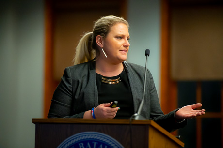
City Council has a choice for this year’s budget: vote to override the state-mandated tax cap or prepare to tighten the belt for significant cuts and make ends meet.

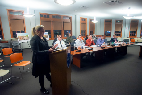
That may sound like an ultimatum, but it’s how this year’s 2023-24 budget is panning out so far, City Manager Rachael Tabelski says. She gave a budget presentation to council during Monday’s conference session at City Hall.

Healthcare, inflation, diesel fuel, employee salary and retirement costs are all on the rise, and the tax cap allows a levy increase of $154,000 when what’s needed is $450,000, Tabelski said.

Councilman Bob Bialkowski faced the elephant in the room and asked what happens if the group votes not to override the tax cap, “we raise property taxes?” Or make cuts, Council President Eugene Jankowski Jr. said.

Yes, more likely it would be the latter, Tabelski said: “That would mean significant cuts,” she said to The Batavian after the meeting.

“The tax cap is an arbitrary formula given by the state. You know, the only thought this year was that we can raise this revenue and continue the level of services that have expanded slightly in the last year or so. We have a full-time parking and recycling officer, a full-time ordinance officer, another firefighter that was contractually obligated through a contract signed before I was here,” she said. “To cover those costs, plus health care's up $457,000, retirement costs are up $300,000 … I would say this is this year's request, that the city would do everything in its power to maintain under the tax cap in the future.”

That means that, hopefully, this won’t be a recurring ask, she said. City Council would have to approve the measure by at least a 60 percent yes vote.

Can department heads dig deeper and reduce their budget requests?
“This is the bare bones budget. We've already gone through that process of every department, and they present to me, obviously, what they'd like to see in the budget, and then we cut that back significantly to get to this point,” she said. “This is to maintain the level of employees we have at fair wages and to make sure we can pay social security and health care for those employees. Those are the main drivers, plus the inflationary prices of gas, electric, diesel, fuel, and supplies and materials. So they've already done their value engineering, as we call it. But again, council has budget work sessions that go right through, line by line, each expense and discuss it. And there certainly could be changes that come from that.”

Council members will be going through the budget during the next several weeks to ask questions, make suggestions, and see where other cuts might be made. The one area where Tabelski does not recommend taking from is the unassigned fund balance. That fund is best used as a savings account for future use.

She shared that the fund has grown a bit from an overdue payment from Seneca Power Partners, which had been in arrears with its taxes.

“I will say that we had a payment from Seneca Power of penalties and interest on the tax payments. So my hope is that will really help our unassigned fund balance when we get to the end of the audit year in August,” she said. “But when I do the budget, I don't know that number. I have no way to project what that number is until we get into the audit after the budget books close.”

Other parts of the budget include an extra $275,000 “to reserve funds to prepare to bond for the police facility,” she said.

“So right now, we're putting money into reserves, like our savings, so that we're able to bond when the time comes with the hopes of not having to raise property taxes, and being able to do it within those reserve funds we're putting away right now,” she said. “Kind of like when your car payment rolls off, and you put it into your savings account, and then you lease or buy a new car. You can then use that money in your savings account to pay that new car payment.”

Despite the ominous term of "override the tax cap," the actual tax rate would remain the same, Tabelski said. That would be $8.94 per $1,000 assessed value. She is proposing to raise the water rate by 30 cents. 

Council members will be discussing the budget this month and into February before a public hearing on Feb. 27.

Top Photo: City Manager Rachael Tabelski gives an overview of the past year and 2023-24 budget during City Council's conference session Monday at City Hall; shown with department heads nearby, who have already submitted their "bare bones" budgets for consideration. Photos by Howard Owens.

Corfu woman sentenced by federal judge in African orphanage fraud scheme

By Howard B. Owens

A Corfu woman will serve a year of federal probation after admitting to knowingly participating in a fraud scheme perpetrated by an Internet contact who claimed to represent an orphanage in Africa.

Julie Keller, 57, according to the U.S. Attorney's Office, was contacted by an "Eric Holder" in December 2014, who claimed to be raising money for an orphanage in Africa. 

Starting in July 2015 and until September 2020, Keller received money from numerous people who thought they were contributing to the orphanage project.

Keller raised $182,730.76 from the victims.

She deposited the money in bank accounts that she owned and controlled at First Niagara Bank, M&T Bank, KeyBank, and Bank of America before dispersing funds to other banks outside the United States.

During the course of the scheme, each of the banks closed Keller’s accounts, advising her that the accounts were closed due to suspicious and fraudulent activity.

Even though Keller realized during the course of the scheme that she was receiving funds from donors under false pretenses, according to the U.S. Attorney's Office, she "consciously avoided learning the truth, and continued to deposit funds into her accounts from victims."

It's unclear from the U.S. Attorney's Office statement if Keller kept any of the funds for her own personal gain.

She was ordered to pay restitution of $162,853.59 by U.S. District Judge John L. Sinatra, Jr.

New coach for Batavia Varsity Football: Alex Veltz takes to the field

By Press Release

Press Release:

The Batavia School District Board of Education officially approved, upon recommendation from Superintendent Jason Smith and Athletic Director Michael Bromley, the appointment of Alex Veltz as Head Coach of the Batavia High School Varsity Football program. 

Veltz is a Batavia High School graduate (Class of 2005) and a member of the 2003 and 2004 Varsity Football teams. In 2018, he returned to BCSD as a social studies teacher at Batavia High School. 

He joined the Batavia Football program coaching staff in 2012 and 2013 as a defensive coordinator for the JV team, then returned in 2019 as the JV offensive coordinator and moved to the Varsity program in 2021 as the offensive coordinator. 

“I’ve always wanted to be a head coach,” said Alex Veltz. “I hold this program near and dear to my heart—I went to school here, I played here, and I’m proud of our achievements. I look forward to building on the success Coach Brennan Briggs, my former teammate, started, and I’m eager to continue to grow this program. I want to thank Mr. Smith, Mr. Bromley, and my family for their support and faith in my vision for this team.”

“I’ve had my eye on Alex Veltz as a standout coach from the moment he came back to our football program five years ago,” said Athletic Director Michael Bromley. “The secret to Batavia’s continued success is hiring Batavia alumni. Like those alums before him, Alex has a special passion for Batavia as a former student, player, and now teacher and coach. I know no one will outwork or outcoach Alex, and I can’t wait to see everything he’s going to do with this program.” 

“Alex Veltz is a Blue Devil through and through,” said Superintendent Jason Smith. “He is committed to continuing the success our football program has already achieved while also holding out student-athletes to a very high standard both on and off the field. I speak for all of BCSD to say we can’t wait for the next football season!”

Photo of Alex with his son Charlie.

Corfu Fire makes up for lost time, names top firefighters for past three years

By Howard B. Owens

After missing installation dinners for two years because of COVID-19, the Corfu Volunteer Fire Department caught up on its annual awards on Saturday night, honoring top firefighters for 2020, 2021, and 2022.

Bruce Fauth, pictured above with Dean Eck and Greg Lang, was recognized for his 50 years of service and named Firefighter of the Year for 2020.

Jim Hale, with Assemblyman Steve Hawley, was recognized as a top responder.

Megan Stiles was named Firefighter of the Year for 2021.

Brian Schollard was named Firefighter of the Year for 2022.

Don Newton, chief of East Pembroke, was named an honorary member of the Corfu department for his hard work and service to the community.

Emergency Management Coordinator Tim Yaeger administered the Oath of Office for the 2023 officers. Greg Lang, chief, Dean Eck, deputy chief, Dan Smith, assistant chief, Tyler Lang and Jim Hale, captains, Megan Stiles and J.T. McCarthy, lieutenants, Dillon Hale, first aid captain, Krista Bellassai, first aid lieutenant, Rob McNally, fire police captain, Matt Lenhard, fire police lieutenant, Justin Rodland, safety officer.  The board for 2023 is Dillon Hale, president, Jacob Stiles, vice president, Jennifer Eck, treasurer, Paula Trapani, secretary, Jayden Eck, sergeant at arms, and trustees, Josh McMartin, Megan Stiles, and Matt Lendard.

Suspect in Elm Street shooting maintains his innocence, rejects plea offer, wants trial

By Howard B. Owens
Jeremy Ives

Jeremy G. Ives, accused of firing a shotgun and injuring two people on Elm Street last August, maintains his innocence, said his attorney, Joseph Lobosco, after a hearing where Ives rejected a plea offer from the District Attorney's Office.

ADA Will Zickl said under the terms of the offer, the counts against Ives would be reduced to a single count of attempted assault in the first degree, a Class C violent felony.  Ives, who has a prior DWI conviction, would admit to the charge as a second-felony offender.

He would have been facing a possible sentence of five to 15 years.

In September, a grand jury indicted Ives on counts of attempted assault in the first degree, a Class C violent felony, kidnapping in the second degree, a Class B violent felony, criminal use of a firearm in the first degree, a Class B violent felony, two counts of criminal use of a firearm in the second degree, a Class C violent felony, and menacing in the second degree, a Class A misdemeanor.

If convicted at trial, Ives faces a sentence of nine to 25 years in prison.

Today was the plea cutoff date, the date a defendant can accept a negotiated plea offer. In Genesee County, when a defendant rejects a plea offer on the cutoff day, the case is scheduled to go to trial, and the defendant is unlikely to get a second chance to accept the offer.

Judge Melissa Lightcap Cianfrini scheduled jury selection to start March 20, with a week-long trial expected.

She will hear pre-trial motions on Feb. 15.

The trial was originally scheduled to start two weeks earlier, but the DA requested a DNA sample from Ives, which he provided.

Citing the likely delay while the attorneys await lab results and the subsequent investigation of those results, Lobosco petitioned the court to reduce his client's bail.  It's currently $100,000 cash, $200,000 bond, or $500,000 partially secured bond.

He said that the trial is likely to be delayed further because once the DA's office receives the DNA results, the defense has 30 days to have a DNA expert review the report, and if that expert disagrees with the findings of the people's expert, the DA has 30 days to review those findings, meaning the trial could be pushed back, up to 60 days more.

Zickl opposed modifying the securing order since a two-week delay is minimal.  

Cianfrini denied the motion, but "without prejudice," meaning if it looks like the DNA results report could lead to further delays in the trial, Lobosco can make a new petition to the court for a bail reduction.

ReAwaken organizers, host fight back on what they call 'intimidation,' 'libel,' from AG

By Joanne Beck

Five months after the much-debated and narrowly criticized — mostly by local church groups — ReAwaken Tour hit Batavia, the event still haunts organizers in the form of a letter sent by the state attorney general last August.

After an attempt to obtain a retraction from Letitia James in October, event organizers Clay Clark and Paul Doyle, pastor of Cornerstone Church in Batavia, took legal action and filed a lawsuit against the top law enforcement officer on Jan. 20.

“Mr. Clay Clark and I obtained an attorney and filed a Federal complaint to Attorney General Letitia James in October 2022 giving her an opportunity to make a public retraction of her statements made in the letter sent to us, as they were not founded upon truth or evidence, but rather theoretical discourse, and were issued with ill intent to cause fear, intimidation and harm to Clay Clark, Cornerstone Church and myself,” Doyle told to The Batavian. “Her job is to protect The People of New York, not vilify, entrap, or create false propaganda to inhibit our pursuit of life, liberty and happiness.”

He was unable to speak further at the time but has said he will do so at some point. Meanwhile, The Batavian has obtained a copy of the letter and lawsuit, filed solely against James for her August letter pursuant to the New York State Human Rights Law, New York City Human Rights Law, and New York State Civil Rights Law for “negligence, defamation, libel, and discrimination on the basis of race, color, religion, and political affiliation.”

Plaintiffs include Paul Doyle, senior pastor at Cornerstone Church, 8020 Bank Street Road, Batavia, and Clay Clark, coordinator and organizer of the Reawaken America Tour, Oklahoma.

“Specifically, plaintiff alleges that the Defendants negligently, wantonly, recklessly, intentionally, and knowingly sought to and did deprive them of their constitutional and civil rights, pursuant to the above-named statutes and causes of action by committing acts to deprive Plaintiffs of rights secured by the Constitution of the United States and the State of New York,” the suit states. “Further, Defendant James negligently, wantonly, recklessly, intentionally, and knowingly published multiple false statements to multiple media outlets to mar the reputations of Pastor Doyle and Clay Clark, to provoke objectionable opinions in the minds of members of the community to expose plaintiffs to hatred, contempt, and aversion.”

The Tour had originally been scheduled for a venue in Rochester last summer, but as controversy and protests grew louder, it was canceled. Doyle then agreed to host the event at his church campus on Bank Street Road, which drew similar protests, fear and claims of violence related to white supremacists. About two weeks before the event occurred, James stepped in and sent a letter that began by introducing herself as “New York’s top law enforcement officer.” It was addressed to General Michael Flynn and Clay Clark, and copied to Cornerstone Church.

“I have significant concerns that the ReAwaken America Tour’s upcoming event at the Cornerstone Church … could spur extremist or racially motivated violence,” James said. “These concerns center around the event’s proposed dates, which coincide with the five-year anniversary of the deadly Unite the Right rally in Charlottesville, Va., and past extremist statements made by yourselves and the other featured speakers on the tour.”

The letter can be considered nothing less than “an attempt to covertly intimidate and threaten the plaintiffs into shutting down the event,” the suit states. James makes numerous statements that are “facially incorrect, libelous, and covertly threatening towards both Plaintiffs. Her actions are politically motivated and the concerns Ms. James relays in her letter are a cloak for her passive threats to prosecute plaintiff Doyle, Clark, and others associated with the event strictly for their political views,” it states.

Her letter was not the only tool for either dissuading the event from happening or expressing strong concern about it. Local church and nonprofit groups formed a coalition to protest, speak out, carry signs and hold a vigil in efforts to lessen the strength of what they perceived to be a dangerous event about to take place. Their concerns overlapped with those of James, including racism, white supremacy, violence, discrimination, and an overall violation of civil rights.

James’ letter continued on to remind the organizers that New York law prohibits “racially motivated violence, harassment, or interference with another person in the exercise of their civil rights,” and that Civil Rights Law 79-n empowers her office to investigate acts of violence, intimidation, threats, or harassment directed at people based on a belief or perception regarding an individual’s race, color, national origin, ancestry, gender, religion, religious, practice, age, disability, or sexual orientation.

“In addition to actual damages,” she continues, “any person who violates this statute can be held liable for $5,000 in penalties for each violation.”

The lawsuit also alleges that James’ “reckless threats” to prosecute the plaintiffs along with her inferences towards racial discrimination and fraud associated with the church and the event were publicized in numerous media outlets and which have injured Pastor Doyle’s reputation, that of his church, and the reputation of Mr. Clark as well.

“As a result, Pastor Paul and Cornerstone Church now have a smear against their names which has created a suspicious taint on the relationships they have worked diligently to develop,” it states. “Yet, despite its years of sacrifice and service to the community and its youth, Ms. James decided to forego any reasonable inquiry into the church to verify her alleged concerns, as required of her as the top law enforcement officer.”

Item #55 cites the Supreme Court, “that speech critical of the exercise of the State's power lies at the very center of the First Amendment,” and as a result, "a section 1983 claim will lie where the government takes negative action against an individual because of his exercise of rights guaranteed" by the First Amendment.

“The plaintiff in this action has an undeniable right to associate and speak freely in accordance (with) the First Amendment,” it states. “The letter sent by the Defendant was meant to intimidate and harass the Plaintiffs into not exercising these rights through government coercion and veiled threats of investigation and prosecution into Pastor Paul and Cornerstone Church, Clay Clark, and the ReAwaken America Tour.”

The organizers, via the lawsuit, accuse James for taking actions that “constitute a blatant abuse of authority” that’s been granted to her by the state.

The Attorney General's Office did not immediately respond to The Batavian with comment.

Top File Photo: Pastor Mark Burns prays for Attorney General Letitia James after she sent a letter warning organizers about hosting the tour in Batavia; General Michael Flynn offers a message during the two-day event; Pastors Lee and Paul Doyle talk to the crowd under the tent alongside Cornerstone Church in August 2022. Photos by Howard Owens.

Authentically Local